weather forecast and Flooding

Floods and Flooding

cyclones and hurricanes

LATEST HIGH RESOLUTION HURRICANE SATELLITE IMAGES

Keep up to date with floodwarn

Share /save is the easy way to add us to your favourite list and share with your friends

Share/Bookmark

Hurricane High resolution Satellite images

Hurricane weather latest
Hurricane weather latest Atlantic  names
 

Hurricane weather latest Pacific names

National Floodwarn Hurricane information and news centre

This page contains information on conditions for formation of hurricanes. We have Wind Sheer maps, Convergence & Divergence maps for help predicting where tropical storms and hurricanes will for or intensify. satellite images and discussions can be found on our main Hurricane Centre Page

Floodwarn is provided completely free but the costs of running and hosting this site are not free. It is really appreciated that some users donate towards the running of the site and we have added a donate button to make this easier.

feeds

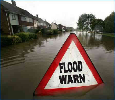
Buoy and ship weather reports - click here

Please support us by clicking the + button

aaa

Current Atlantic Surface Weather Analysis

Tropical Atlantic WidLatest live satelite image of earth day or night
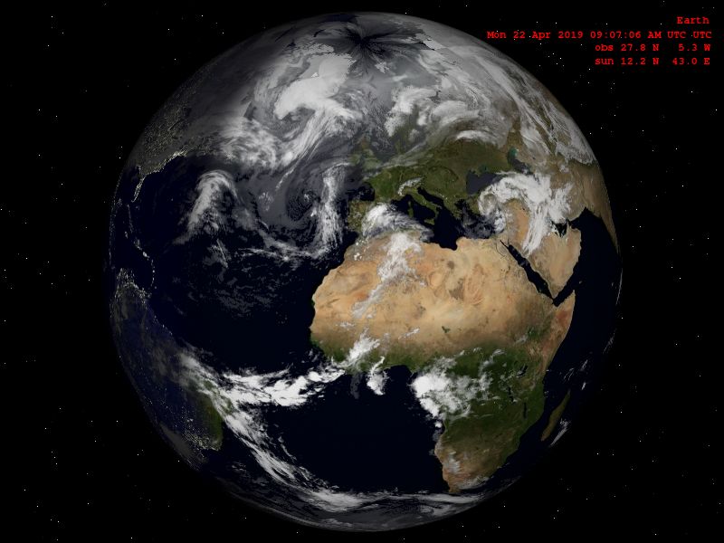
e Water Vapour Satellite Image

latest hurricane satellite Courtesy of NOAA Satellite Services Division

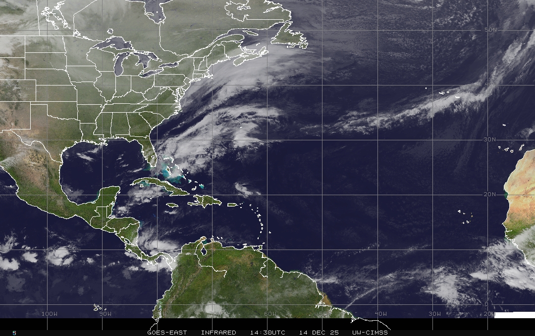
Western Atlantic Infrared Satellite Image

<
North Atlantic:
hurricane latest
Western Atlantic:
tropical weather latest
Central Atlantic:
hurricane in carribean
Gulf of Mexico:
tropical storm satelite image
Caribbean:
latest satelite image of hurricane
US East Coast:
hurricane latest image
Northwest Atlantic:
Atlantic hurricane satelite image

Infrared Satellite Images


Visible Satellite Images

p align="center">hurricane latest satelite image Courtesy of UW-Madison CIMSS Tropical Cyclones Research Group

Tropical Atlantic Wide Infrared Satellite Image

National hurricane center satellite Courtesy of NOAA Satellite Services Division

Sea surface temperatures Courtesy of NOAA

12 Hour Forecast - Favorable Environmental Conditions For Tropical Development

12 hrs hurricane forecast map Courtesy of PSU E-Wall

24 Hour Forecast - Favorable Environmental Conditions For Tropical Development

24 hour forecast hurricane map 1 day Courtesy of PSU E-Wall

36 Hour Forecast - Favorable Environmental Conditions For Tropical Development

2 day hurricane prediction Courtesy of PSU E-Wall

48 Hour Forecast - Favorable Environmental Conditions For Tropical Development

next 48 hour hurricane prediction Courtesy of PSU E-Wall

60 Hour Forecast - Favorable Environmental Conditions For Tropical Development

3 day hurricane outlook Courtesy of PSU E-Wall

72 Hour Forecast - Favorable Environmental Conditions For Tropical Development

72 hour hurricane prediction Courtesy of PSU E-Wall

96 Hour Forecast - Favorable Environmental Conditions For Tropical Development

4 day hurricane outlook Courtesy of PSU E-Wall

120 Hour Forecast - Favorable Environmental Conditions For Tropical Development

5 day hurricane forecastCourtesy of PSU E-Wall

72 Hour Atlantic Wind Shear Forecast

hurricane Wind shearforecast   Weather Underground

Current Sea Surface Temperature Analysis

Sea surface temperatures Courtesy of NOAA


Water Vapour Satellite Images

North Atlantic:
tracking hurricane
Western Atlantic:
latest hurricane tracks
Central Atlantic:
hurricane forecast
Gulf of Mexico:
hurricane latest satelite image
Caribbean:
click to view hurricane
US East Coast:
free hurricane news
Northwest Atlantic:
hurricane forecasts
Tracking Chart--Click to enlarge
[Click on above chart to enlarge]
Atlantic satellite  Loop
Atlantic Surface Analysis
Enhanced InfraRed satellite loop - Click to enlarge
North Atlantic:
water vapour satelite image of hurricane
Western Atlantic:
latest water vapour satelite picture
Central Atlantic:
Tracking the hurricane
Gulf of Mexico:
latest tropical storm outlook
Caribbean:
latest hurricane image
US East Coast:
latest tropical storm image
Northwest Atlantic:
Hurricane prediction & forecast centre
 

Infrared EUMETSAT image latest:
Hurricane prediction & forecast centre

Courtesy of Eumetsat COPYRIGHT EUMETSAT 2010

Pacific Graphical Tropical Weather Next 24hrs Outlook


Pacific hurricane satelite images and latest forescast

National hurricane centre Hurricane forecast

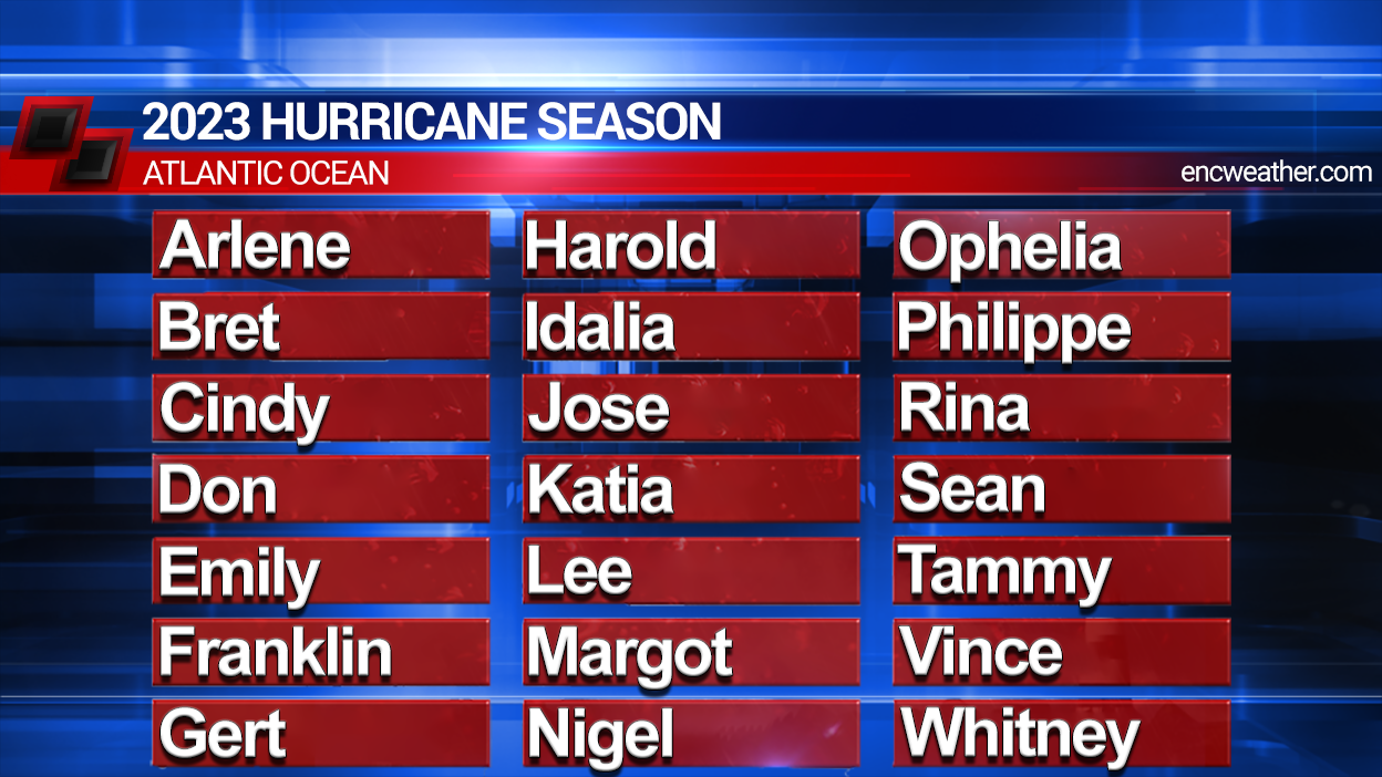
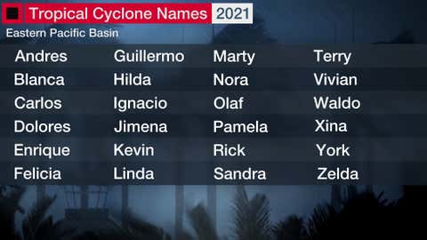
Eastern North Pacific Names 2012

Tropical Storm or Hurricane Agatha
Tropical Storm or Hurricane Blas
Tropical Storm or Hurricane Celia
Tropical Storm or Hurricane Darby
Tropical Storm or Hurricane Estelle
Tropical Storm or Hurricane Frank
Tropical Storm or Hurricane Georgette
Tropical Storm or Hurricane Howard
Tropical Storm or Hurricane Isis
Tropical Storm or Hurricane Javier
Tropical Storm or Hurricane Kay
Tropical Storm or Hurricane Lester
Tropical Storm or Hurricane Madeline
Tropical Storm or Hurricane Newton
Tropical Storm or Hurricane Orlene
Tropical Storm or Hurricane Paine
Tropical Storm or Hurricane Roslyn
Tropical Storm or Hurricane Seymour
Tropical Storm or Hurricane Tina
Tropical Storm or Hurricane Virgil
Tropical Storm or Hurricane Winifred
Tropical Storm or Hurricane Xavier

<