Share /save is the easy way to add us to your favourite list and share with your friends

FLOOD INFORMATION AND PREDICTION |
Hurricane Centre Maps
National Floodwarn Hurricane information and news centre
This page contains information on conditions for formation of hurricanes. We have Wind Sheer maps, Convergence & Divergence maps for help predicting where tropical storms and hurricanes will for or intensify. satellite images and discussions can be found on our main Hurricane Centre Page
Hurricane webcam's
Pacific Hurricane news and warnings
Main Hurricane Centre Click Here
For hurricane strike probability please see the tracking page
Hurricane Centre by Floodwarn is provided completely free but the costs of running and hosting this site are not free. It is really appreciated that some users donate towards the running of the site and we have added a donate button to make this easier.
 View RSS feed

Floodwarn has opportunities for low cost advertising or sponsor
|
|
Weakening Factors
Even when the conditions are right for hurricane formation at the surface, the storm may not form if the atmospheric conditions above the surface are not favorable.
E.G, around the area of 20 degrees latitude, the air aloft is often sinking, due to the presence of the sub-tropical high, a semi-permanent high pressure system in the subtropical regions.
The high pressure pushes air towards the surface. The sinking air warms and creates a temperature inversion, an extremely stable air layer in which temperature increases with altitude, the opposite of the usual temperature profile in the lower atmosphere.
Called the trade wind inversion, this warm layer is very stable, which makes it difficult for air currents to rise and form thunderstorms and hurricanes.
In addition, strong upper-level winds tend to rip apart developing thunderstorms by dispersing the latent heat and preventing the warming temperatures that lead to lower air pressure at the surface.
At the surface, hurricanes can diminish rather quickly given the right conditions. These conditions include the storm moving over cooler water that can’t supply warm, moist tropical air and convection; the storm moving over land, again cutting off the source of warm, moist air; and finally, the storm moving into an area where strong winds high in the atmosphere disperse latent heat, reducing the warm temperatures aloft and raising the surface pressure.

GFS prediction
surface wind 24 hrs

GFS prediction
surface wind 48hrs

GFS prediction
wind sheer 48 hrs time

WIND SHEER AT MID LEVELS ( LATEST )

LATEST WIND SHEER AT UPPER LEVELS
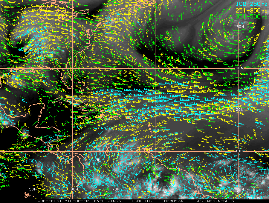
LATEST LOW LEVEL CONVERGENCE CHARTS FOR HURRICANES
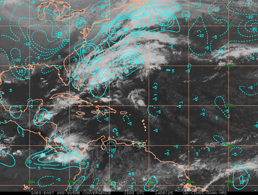
LATEST HIGH LEVEL DIVERGENCE CHARTS FOR HURRICANES
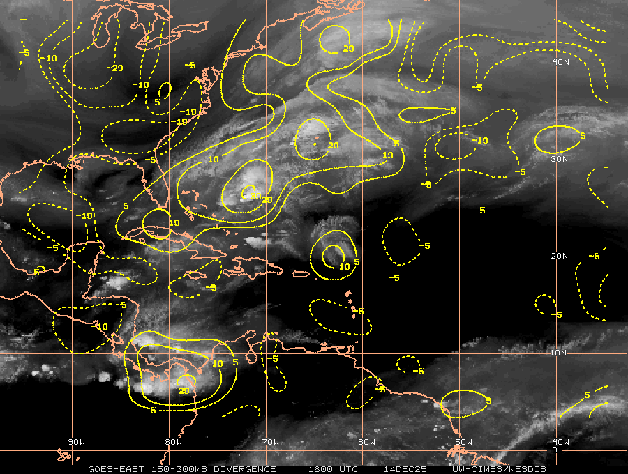
LATEST LOWER LEVEL WIND SPEEDS FOR HURRICANES IN ATLANTIC
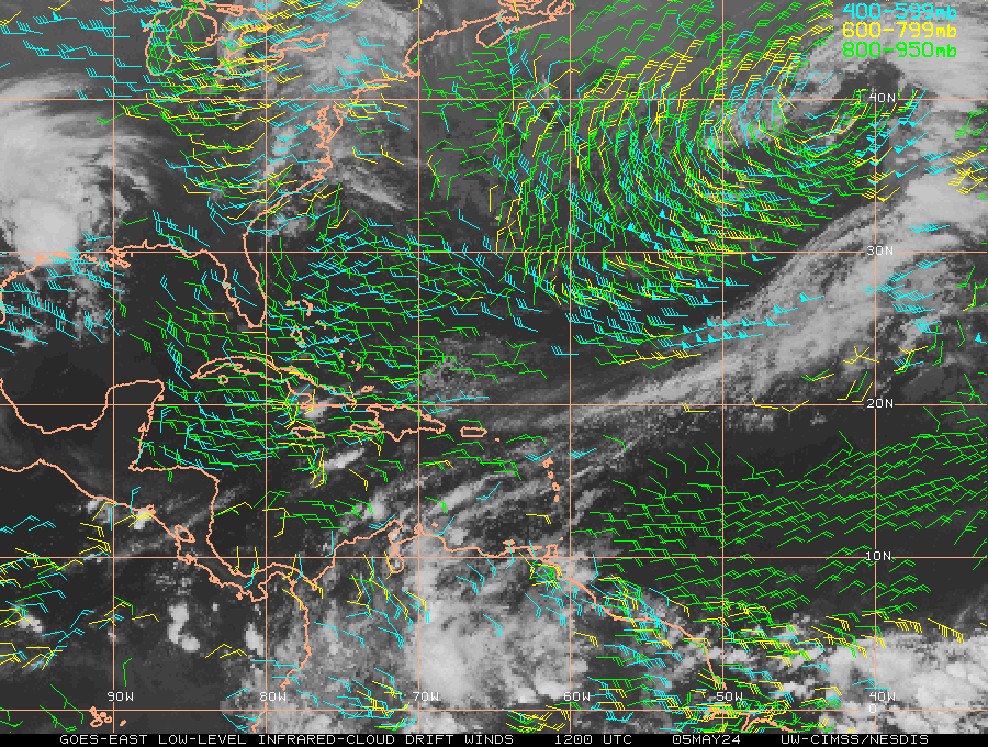
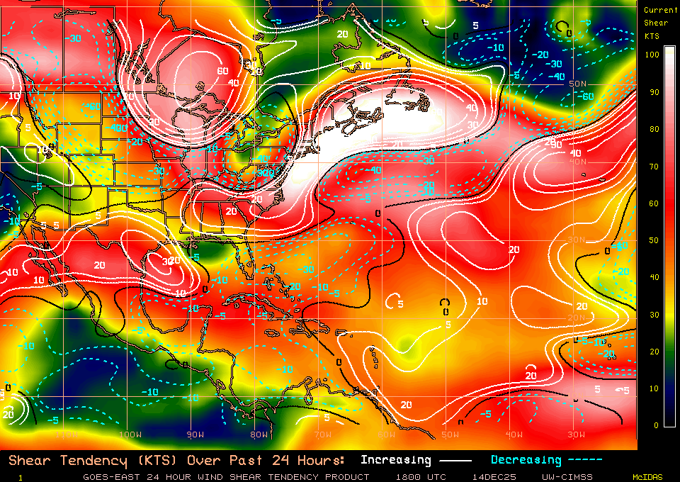
LATEST WIND SHEER TENDENCY CHARTS FOR HURRICANES
To use this chart the current sheer speed is shown on right side
and is shown as colour.
The tendency is shown as white for increase and blue dotted decrease in
lines.
The number shows the amount of increase or decrease
Hurricane watch
Use
this interactive map
+ or - to zoom out (see systems heading for UK)
Add clouds or
forecast hurricane strike probability
Hurricane webcam's for watching approaching hurricanes. Web Cams in Caribbean and Gulf Coast webcam for hurricane watching live
