LIVE ....web cams of the Iceland Volcano live information on the ash cloud and plume. links to monitor the volcano
Katla Volcano about to erupt - according to some news media - NOT TRUE
There is no more signs that Katla is about to erupt than last few months.
Infact seismic activity appears to be very low at this time.
For truth on Volcanic activity at Katla please useFloodwarn,Iceland Met OfficeorJon Frimmann Blog
You may be asked to let an add on access your computer this is normal for windows media player to access the web cam
This is normal
We have no control over the web cams directly and just provide a convenient viewing platform ( ie side by side cams) for users to view this awesome spectacle provided by nature.
The cams are positioned in very remote areas and currently in the areas there are power outages that cause the cameras to go offline.
In addition some cameras are positioned in no go areas with the current eruption and so a failure can not be repaired.
Below is the Hekla Volcano webcam
Hekla is the most active volcano in Iceland and often referred to as the Queen of Iceland´s volcanoes.
Hekla last erupted in February of 2000. Scientists believe that Hekla is likely to erupt soon and if that happens – you will be able to watch it happen live on the Hekla web cam – right here on floodwarn!
If this Katla webcam is not working try the Live Mila Katla webcam fiurther down page
Latest information
05/10/2011 Katla has had numerous earthquakes since the early hours of this morning, this swarm of quakes have been nearer the surface and have been intense with 4.1 registered on the scale.
This indicates that something is happening with Magma moving towards the surface.
Iceland met report no eruption at this time.
Floodwarn believe some form of eruption is likely in the next few days and possibly within hours.
The webcam on Katla has not been working for last 24 hours, we hope it gets fixed soon, this is not to do with any eruption but more likely technical or weather related fault
Iceland's massive volcano Katla appears on the brink of a major eruption just days after officials confirmed they had detected the start of eruptions over the summer.
Measuring devices this morning have picked up a large earthquake swarm, usually a tell-tale sign of a potential volcanic eruption.
The Icelandic Government last month announced it was increasing monitoring Katla,
which is one of Europe's most feared volcanoes, following a consistent and strengthening spike of tremors and quakes.
And last week, officials at the Iceland Meteorological Office confirmed a series of smaller eruptions had occurred in July strengthening fears of an imminent, much larger, eruption.
Evidence gathered by geophysicists showed the magma had risen to the height of the glacier ice above the volcano causing it to melt.
It is believed Katla, named after a vindictive troll of Viking folklore, has the potential to be much stronger and disruptive than the last two Icelandic volcanic eruptions that caused chaos across Europe's air space, grounding flights and closing airports.
Katla is much larger than its neighbouring Eyjafjallajokull – which erupted last year (2010) - with a magma chamber about 10 times the size.
Volcanologists warn that if Katla does erupt, and its a major eruption then the combination of the magma and the large ice sheet covering the volcano could lead to explosive activity and an ash plume for weeks, if not months.
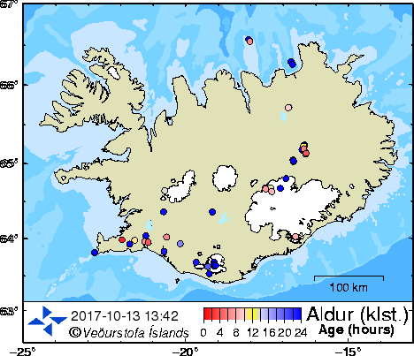
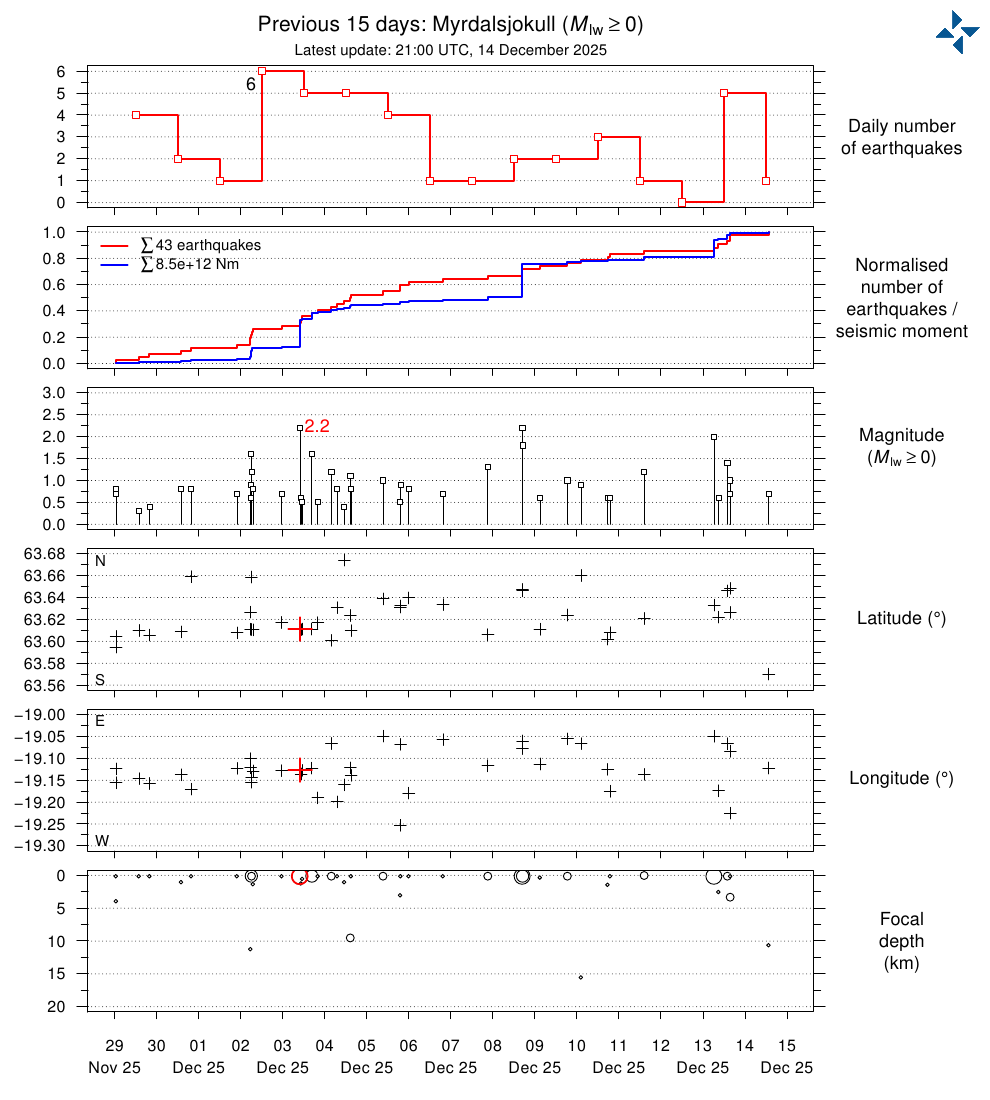
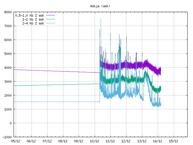
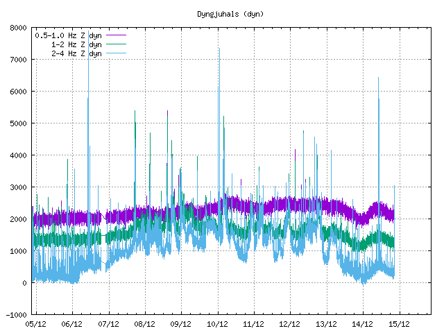
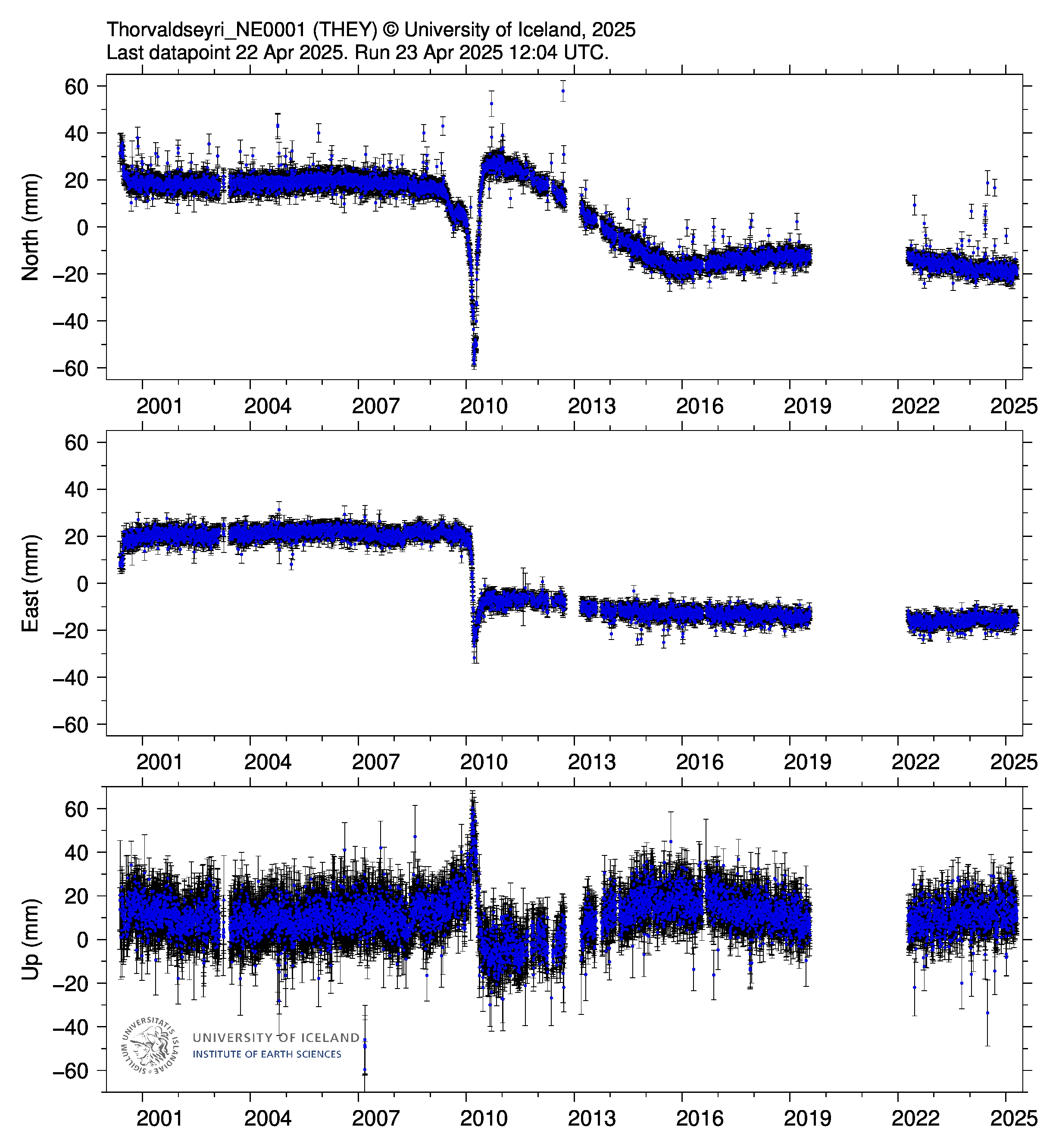
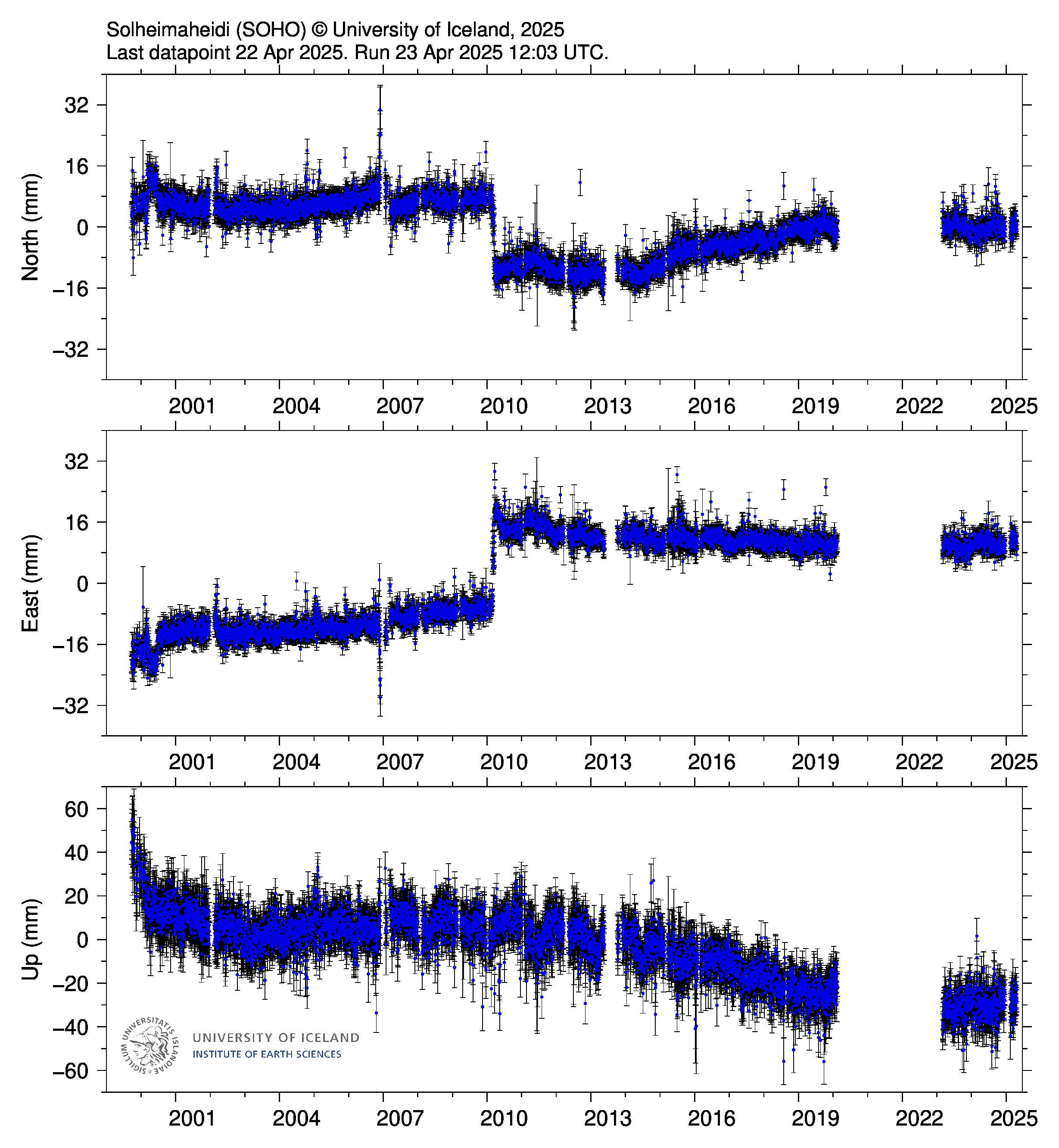
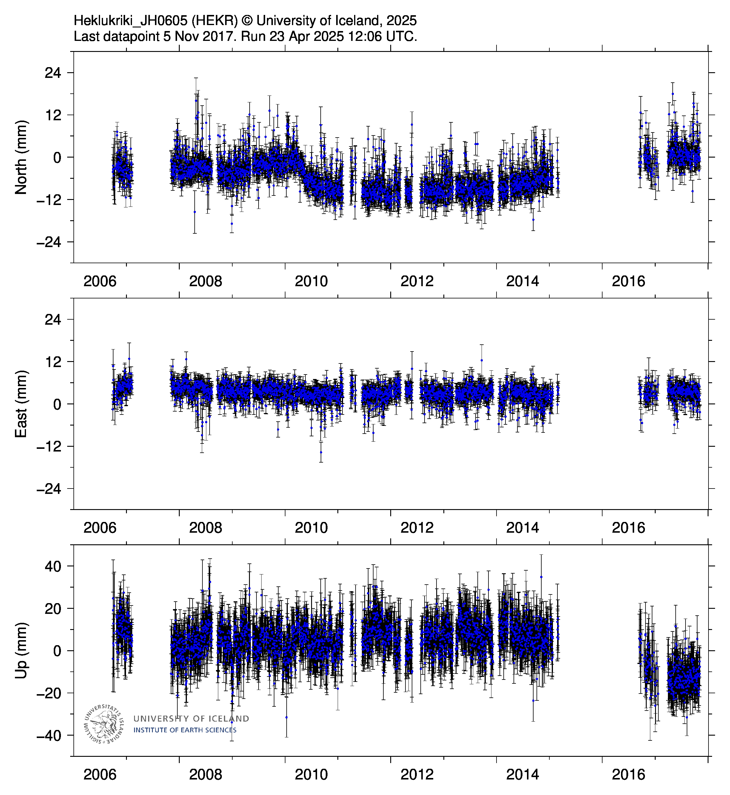
Latest Earthquakes in Iceland (Volano seismic activity)
Locations of earthquakes in Iceland for the last 48 hours. The image is refreshed every 2 minutes. The circles on the map represent earthquakes for the last 48 hours. The colors of the circles represent the time since the earthquakes occured (the numbers below the color palette show hours). The latest earthquakes are shown in red and the darkblue ones are 24 hours old or more. The earthquakes stay blue until they are 48 hours old, then they disappear. Earthquakes bigger than M3 (on Richtersscale) are represented with green stars. Black triangles represent seismic stations (the SIL system) and brown lines show roads.
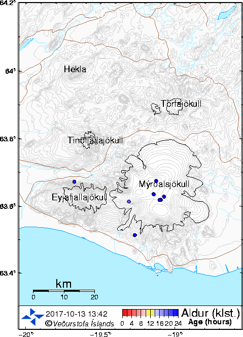
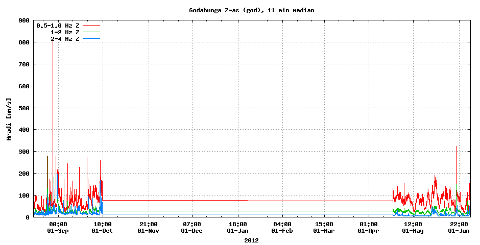
Latest Earthquakes at Katla Volcano
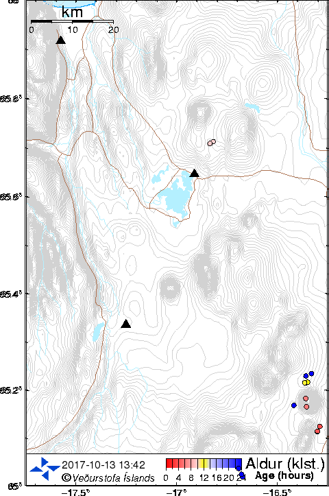
Latest Earthquakes at Mývatn Volcano
Katla Volcano live seismic activity HVO harmonic tremor plot
Copyright of this picture belongs to Iceland Met Office
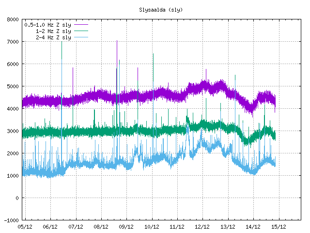
Katla Volcano live seismic activity Sil (Slysaalda) harmonic tremor plot
Copyright of this picture belongs to Iceland Met Office
Katla Volcano live seismic activity tremor plot
Copyright of this picture belongs to Jon Frimann
Webcam image of Katla showing where Katla is for cam below it
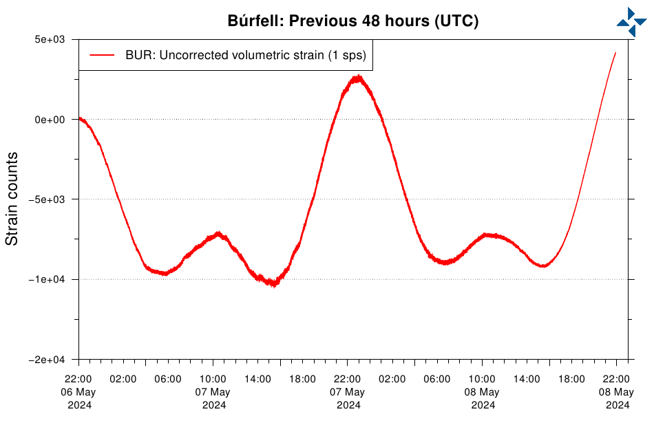
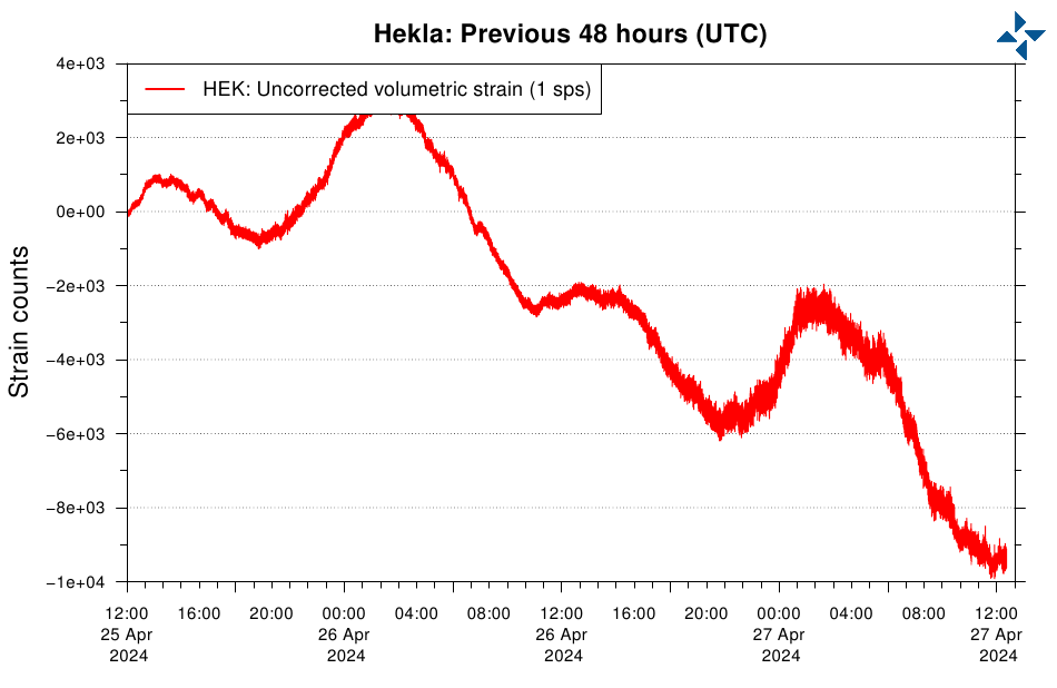
Hekla Borehole Strain & Seismicity
Strainmeters
Strainmeters are used to measure the stress on a particular part of the Earth's crust, usually a fault. Strain meters work by measuring movement between two distant points.
For example, if the distance between two points located one kilometer apart changes by one millimeter, the resulting strain is considered to be one microstrain.
Strainmeters generally measure changes from positions in boreholes in the Earth's surface.
The charts to take notice of are the "esk" for
Eyjafjallajökull
and "hvo" for katla although some seismic activity will be shown in all Live EARTHQUAKE info
The “Ring of Fire” also called the Circum-Pacific belt, is the zone of earthquakes surrounding the Pacific Ocean — about 90% of the world’s earthquakes occur there. The next most seismic region (5-6% of earthquakes) is the Alpide belt (extends from Mediterranean region, eastward through Turkey, Iran, and northern India.
The greatest mountain range is the Mid-Ocean Ridge, extending 64,374 km (40,000 mi) from the Arctic Ocean to the Atlantic Ocean, around Africa, Asia, and Australia, and under the Pacific Ocean to the west coast of North America. It has a greatest height of 4207m (13,800 ft) above the base ocean depth.
Subduction is the process of the oceanic lithosphere colliding with and descending beneath the continental lithosphere.
This Site is to be used for information only.
The data on this site is provided for purpose of information only and is not intended for any other reason, including but not limited to flood forecasting, flood prevention or predicting actual weather severity. It is up to you the user to decide if you need to take action and what action if any to take. Floodwarn shall not be liable for any errors, inaccuracies,misrepresentations, delay in the content, or for any action taken or not taken in reliance thereon. The FloodWarn site contains information that may or may not be accurate.
Please use the UK GOVERNMENT sites for reliable information.
Floodwarn accept your use of this site under these terms only.